
Services / Infrastructure
Inspection and Surveys with UAS
Engineering services with the use of UAS technology
Precision farming
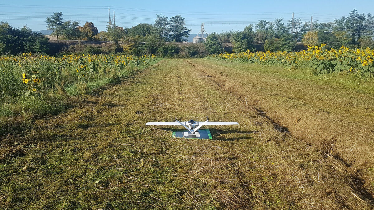
Optimization of the agricultural production thanks to the monitoring the cultivation’s state of health.
AISICO uses drones, also in BVLOS (Beyond Visual Line of Sight) mode, equipped with infrared, multispectral and thermal sensors, to monitor the health of a plot of land or a crop.
Through the processing of data, detailed thematic geo-referenced maps are created, useful both for the identification of crop parameters, such as vigor, stress / water excess, yield, etc.., and for the realization of prescription maps, useful for the planning of punctual interventions.
The combination of collected data and the use of machinery with variable rate technology (VRT), automates the intervention on crops only where necessary, reducing waste in terms of phytosanitary products and optimizing maintenance costs.
Architectural and photogrammetric surveys
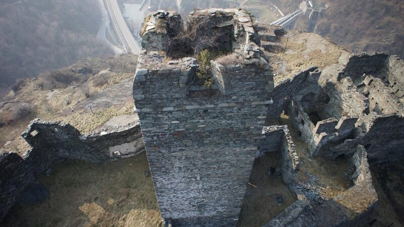
Sottotitolo: Photogrammetric surveys and assessment of the state of preservation of isolated elements, buildings and historical and cultural sites.
AISICO performs architectural surveys of very high precision, easily reaching even areas of difficult access or high risk. From the generated 3D model it is possible to: take measurements of distances, surfaces and volumes, analyze geometry, distortions, depths of lesions, missing or protruding parts and create, thanks to the use of specific AISICO proprietary software, a summary and predictive picture of the state of the property and of its degradation, thus allowing the monitoring, in real time and over time, of the site in question.
Through high-precision photogrammetric surveys, DTM (Digital Terrain Model) models of the terrain are created, capable of reporting georeferenced, precise and punctual data, variable according to altitude, with the identification of contour lines useful for the realization of topographic services, geological surveys and construction site mapping. In post processing it is also possible to realize DSM models (Digital Surface Model) of the surfaces and DEM models (Digital Elevation Model) that include also the surveyed anthropic elements, with less time and costs than traditional techniques.
Environmental and Land Protection
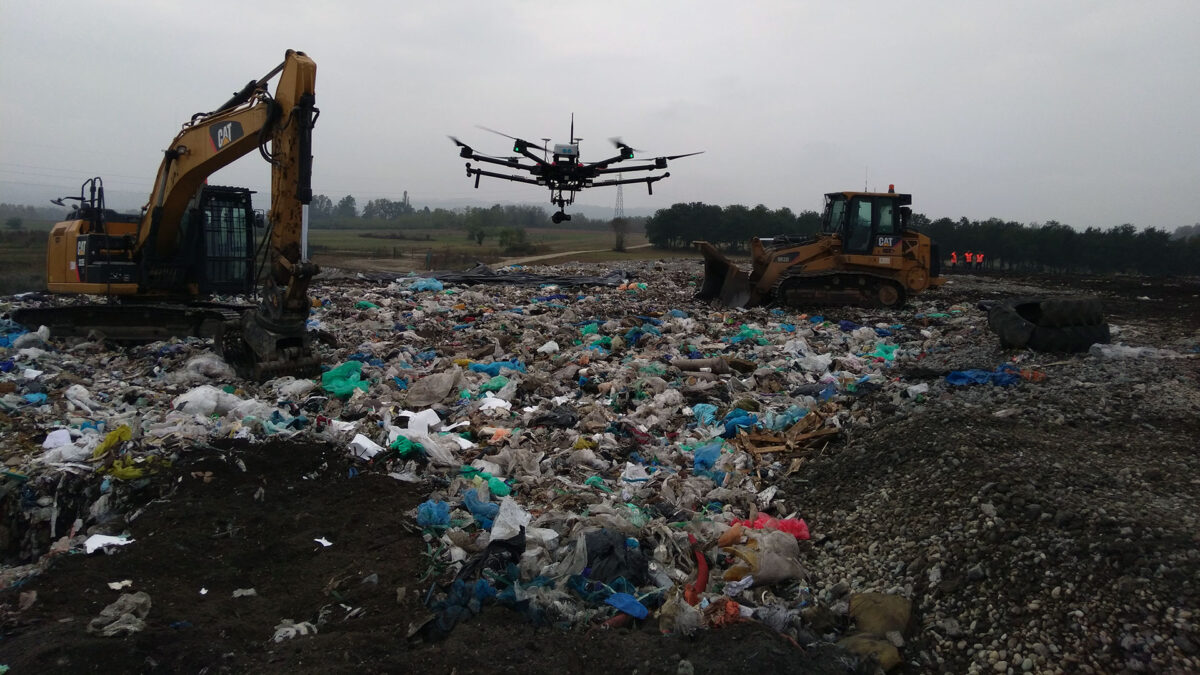
Environmental survey, surveillance and monitoring of large areas and industrial complexes.
AISICO with drones properly equipped, performs environmental surveys and monitoring analyzing and cataloging large areas of land quickly, including areas of difficult access or at risk. Such surveys guarantee a valid aid in the monitoring of follow-ups, natural disasters (including the estimation of damage to agriculture), fire prevention, ecosystem changes and the detection of pollutants and toxic agents.
Drones are equipped with multi-sensors, calibrated to detect specific gases, ensuring proper sampling of urban, industrial and landfill areas. The use of UAS also allows the monitoring of areas at risk of erosion and hydrogeological instability, the assessment of stability and volumetric estimation of landslides and quarry fronts.
Discover our projects for Environment and Territory Monitoring and Protection
Energy production plants and distribution networks
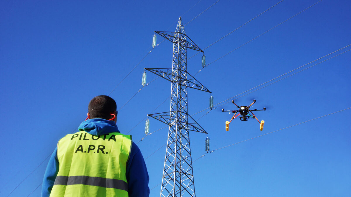
Inspection and condition monitoring of plants using photographic and thermographic sensors
AISICO performs inspections in the energy sector aimed at monitoring both individual elevated structures, such as wind turbines and energy distribution networks, and the condition of distribution pipelines for oil, gas and gas pipelines, ensuring that difficult to access areas are also reached.
Moreover, the use of appropriate sensors installed on drones allows to evaluate the state of efficiency of a photovoltaic park, ensuring a constant monitoring of the area from a complete view, in order to quickly identify anomalies and schedule interventions in order to minimize costs and risks of interventions and without interrupting site activities. It is also possible to use these systems in a preventive manner to carry out a mapping of the terrain in terms of geometry and reflectance in order to better design structures for energy production. Finally AISICO can perform video inspections of dams, large industrial complexes and confined areas such as silos, pipelines, sewage systems.


